doc. Mgr. Jan Kropáček, Ph.D.

Odborné zaměření: hydrologický cyklus a kvalita vody z družicových měření, přírodní hazardy, revitalizace vodního prostředí, změny zalednění v kontextu globálního oteplení
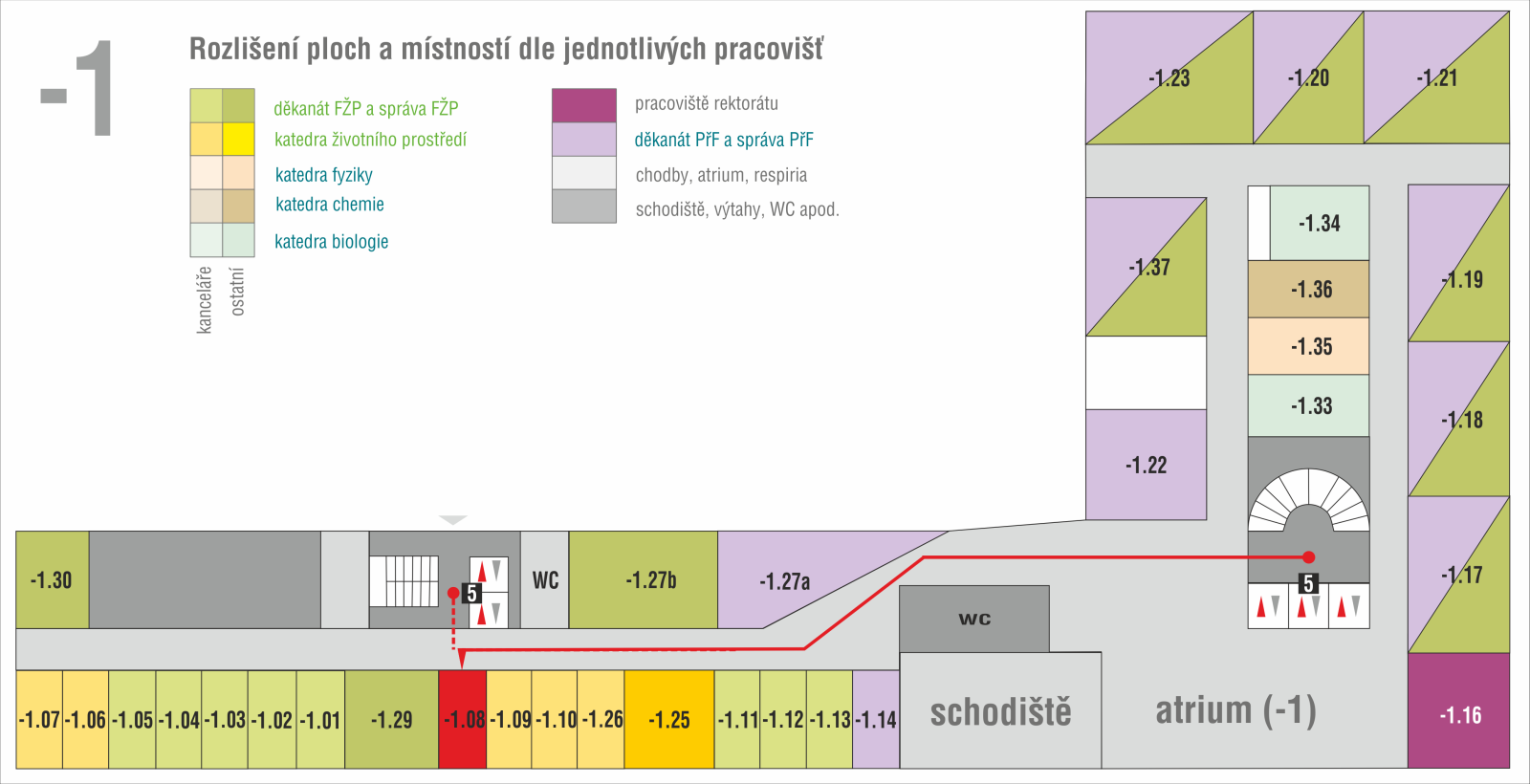
Místnost: CPTO -1.08, Telefon: +420 475 284 195, E-mail:
Konzultační hodiny: čtvrtek 13.00 – 14.00
Researcher ID:
Publikace s IF a v databázi Scopus
2024
Kropáček, J., & Mehrishi, P. (2024). Dynamics of equilibrium line altitude in glaciers of the Monte Rosa massif in the Alps derived from Sentinel-2 satellite images. AUC Geographica, https://doi.org/10.14712/23361980.2024.17
Kropáček, J., Nüsser, M., & Schmidt, S. (2024). Exploring the potential of historical images for the investigation of glacier changes: the case of Belvedere Glacier, Italian Alps. AUC Geographica, DOI: https://doi.org/10.14712/23361980.2024.16
Kropáček, J., Mehrishi, P., Bollati, I.M., Brodský, L., Pelfini, M., Azzoni, R.S., Schmidt, S., Nüsser, M., Vilímek, V. (2024). Dynamics and related hazards of the Belvedere Glacier in the Italian Alps: a review, AUC Geographica, DOI: https://doi.org/10.14712/23361980.2024.21
Kropáček, J. (2024). A novel approach for the representation of multispectral samples in a planar pentagon plot. International Journal of Applied Earth Observation and Geoinformation, 127, 103658.
2023
Bhattacharya, A., Mukherjee, K., King, O., Karmakar, S., Remya, S. N., Kulkarni, A. V., Kropáček, J., & Bolch, T. (2023). Influence of climate and non-climatic attributes on declining glacier mass budget and surging in Alaknanda Basin and its surroundings. Global and Planetary Change, 104260.
Pandey, A., & Kropáček, J. (2023). Rapid formation and drainage of a new glacial lake in the Monte Rosa Massif, Swiss Alps, as observed on Sentinel-2 imagery. Annals of Glaciology, 1-3.
2022
Hasheminasab, S., Rahimi, D., Zakerinejad, R., & Kropáček, J. (2022). Assessment of climate change impact on surface water: a case study—Karoun River Basin, Iran. Arabian Journal of Geosciences, 15(9), 904.
2021
Kropáček, J., Vilímek, V. & Mehrishi, P., 2021, A preliminary assessment of the Chamoli rock and ice avalanche in the Indian Himalayas by remote sensing. The Landslides, https://doi.org/10.1007/s10346-021-01742-1
Nyssen, J., Debever, M., Gebremeskel, G., De Wit, B., Hadgu, K. M., De Vriese, S., Verbeurgt, S. Frankl, A., Besha, B., Kropáček, J., Forceville, A., Demissie, B., 2021, Online digital archive of aerial photographs (1935–1941) of Ethiopia, Geoscience Data Journal, https://doi.org/10.1002/gdj3.115
Perrone, M., Scalici, M., Conti, L., Moravec, D., Kropáček, J., Sighicelli, M., … & Malavasi, M., 2021, Water Mixing Conditions Influence Sentinel-2 Monitoring of Chlorophyll Content in Monomictic Lakes. Remote Sensing, 13(14), 2699.
2020
Cama, M., Schillaci, C., Kropáček, J., Hochschild, V., Bosino, A., & Märker, M., 2020, A probabilistic assessment of soil erosion susceptibility in a head catchment of the Jemma Basin, Ethiopian Highlands. Geosciences, 10(7), 248.
2019
Maerker, M., Schillaci, C., Melis, R. T., Kropáček, J., Bosino, A., Vilímek, V., Hochschild, V., Sommer, Ch., Altamura, F., Mussi, M., 2019, Geomorphological processes, forms and features in the surroundings of the Melka Kunture Palaeolithic site, Ethiopia, Journal of Maps, 15, 797-806.
Engel, Z., Kropáček, J., Smolíková, J., 2019, Surface elevation changes on Lachman Crags ice caps (north-eastern Antarctic Peninsula) since 1979 indicated by DEMs and ICESat data, Journal of Glaciology, 1-12.
2018
Kropáček, J., Vařilová, Z., Nyssen, J., 2018, Historical aerial and terrestrial photographs for the investigation of mass movement dynamics in the Ethiopian Highlands, Land Degradation & Development, 30, 5, 483-493, doi:10.1002/ldr.3220
Kropáček, J., 2018, Erosion dynamics in the southern Tibetan Plateau at a century time scale from historical photographs, Journal of Arid Environments, 161, 2019, 47-54, doi: 10.1016/j.jaridenv.2018.10.00
Moudrý V, Lecours V, Gdulová K, Gábor L, Moudrá L, Kropáček J, Wild J (2018) On the use of global DEMs in ecological modelling and the accuracy of new bare-earth DEMs Ecological Modelling 383:3-9 doi:10.1016/j.ecolmodel.2018.05.006
2017
Kropáček, J., Schillaci, C., Salvini, R., & Märker, M., 2017, Assessment of gully erosion in Upper Awash, Central Ethiopian Highlands based on comparison of archived aerial photographs and very high resolution satellite images. Geografia Fisica e Dinamica Quaternaria, 39, 161-170.
2016
Bhattacharya, A., Bolch, T., Mukherjee, K., Pieczonka, T., Kropáček, J. and Buchroithner, M.F., 2016, Overall recession and mass budget of Gangotri Glacier, Garhwal Himalayas, from 1965 to 2015 using remote sensing data, Journal of Glaciology, 1–19, doi: 10.1017/jog.2016.96.
Kusak, M., Kropáček, J., Vilimek, V., 2016, Analysis of the influence of tectonics on the evolution of valley networks based on SRTM DEM, Jemma River basin, Ethiopia., Geografia Fisica e Dinamica Quaternaria, 39, 37-50.
2015
Kropáček, J., Vařilová, Z., Baroň, I., Battacharya, A., Eberle, J. and Hochschild, V., 2015, Remote sensing for characterisation and kinematic analysis of large slope failures: Debre Sina landslide, Main Ethiopian Rift escarpment, Remote Sensing, 7(12), 16183-16203.
Kropáček, J.; Neckel, N.; Tyrna, B.; Holzer, N.; Hovden, A.; Gourmelen, N.; Schneider, C.; Buchroithner, M. & Hochschild, V., 2015, Periodic Glacial Lake Outburst Floods threatening the oldest Buddhist monastery in north-west Nepal, Natural Hazards and Earth System Sciences, 15(10), 2425-2437. doi: 10.5194/nhess-15-2425-2015.
Vařilová, Z., Kropáček, J., Zvelebil, J., Šťastný, M., Vilímek, V., 2015, Reactivation of mass movements in Dessie graben, the example of an active landslide area in the Ethiopian Highlands, Landslides, 12 (5), 12, 985-996, doi: 10.1007/s10346-015-0613-2.
Haider, V. L., Kropáček, J., Dunkl, I., Wagner, B. & von Eynatten, H., 2015, Identification of peneplains by multi-parameter assessment of digital elevation models, Earth Surface Processes and Landforms, 40 (11), 1477–1492, doi: 10.1002/esp.3729.
Neckel, N., Kropáček, J., Schröter, B., Scherer, D., 2015, Effects of HudHud Cyclone captured by high altitude Automatic Weather Station in north-western Nepal, Weather, 70 (7), 208-210.
Huintjes, E., Sauter, T., Schröter, B., Maussion, F., Yang, Y., Kropáček, J., Buchroithner, M., Scherer, D., Kang, S., Schneider, C., 2015, Evaluation of a coupled snow and energy balance model for Zhadang glacier, Tibetan Plateau, using glaciological measurements and time-lapse photography, Arctic, Antarctic, and Alpine Research, 47 (3), 573-590, doi:10.1657/AAAR0014-073.
2014
Kropáček, J., Neckel, N., Bauder, A., 2014, Estimation of Mass Balance of the Grosser Aletschgletscher, Swiss Alps, from ICESat Laser Altimetry Data and Digital Elevation Models, Remote Sensing, 6, 5614-5632.
Neckel, N., Kropáček, J., Bolch, T. & Hochschild, V., 2014, Glacier mass changes on the Tibetan Plateau 2003–2009 derived from ICESat laser altimetry measurements, Environmental Research Letters, 2014, 9, 014009.
2013
Neckel, N., Braun, A., Kropáček, J., and Hochschild, V., 2013, Recent mass balance of the Purogangri Ice Cap, central Tibetan Plateau, by means of differential X-band SAR interferometry, The Cryosphere, 7, 1623-1633, doi:10.5194/tc-7-1623-2013.
Kropáček, J., Maussion, F., Chen, F., Hoerz, S., and Hochschild, V., 2013, Analysis of ice phenology of lakes on the Tibetan Plateau from MODIS data, The Cryosphere, 7, 287-301, doi:10.5194/tc-7-287-2013.
2012
Kropacek, J., Braun, A., Kang, S., Feng, C., Ye, Q., Hochschild, V., 2012, Analysis of lake level changes of Nam Co in Central Tibet by synergy of satellite altimetry and evaluation of optical satellite imagery. – International Journal of Applied Earth Observation and Geoinformation, 17, 3-11.
2011
Kropacek, J., De Grandi, G., Rauste, Y., 2011, Georeferencing of continental scale JERS-1 SAR mosaics based on matching homologous features with a digital elevation model: theory and practice, International Journal of Remote Sensing, 33, (8), 2413-2433.
2010
Kropacek, J., Feng, C., Alle, M., Kang, S., Hochschild, V., 2010, Temporal and Spatial Aspects of Snow Distribution in the Nam Co Basin on the Tibetan Plateau from MODIS Data, Remote Sensing, 2, 2700-2712.
2009
De Grandi, G.D., Lucas, R.M., Kropacek, J., 2009, Analysis by Wavelet Frames of Spatial Statistics in SAR Data for Characterizing Structural Properties of Forests, IEEE Tranactions on Geoscience and Remote Sensing, 47, (2), 494 – 507.
2007
Durieux, L., Kropacek, J., De Grandi, G.F., Achard, F., 2007, Object-oriented and textural image classification of the Siberia GBFM radar mosaic combined with MERIS imagery for continental scale land cover mapping, International Journal of Remote Sensing, 28 (18), 4175-4182.
Publikace ostatní
Kropáček, J., & Hovden, A. (2024). The Role of Natural Hazards and Socio-Cultural Factors in Shaping the History of Settlement Locations in the Limi Valley, North-West Nepal. In The Nature of Geomorphological Hazards in the Nepal Himalaya (pp. 359-374). Cham: Springer International Publishing.
Schillaci, C., Braun, A. and Kropáček, J. (2015) Terrain Analysis and Landform Recognition. In: Geomorphological Techniques, British Society for Geomorphology, London, Chap. 2, 4.
Účast na konferencích
- Living Planet Symposium Evropské kosmické agentury (ESA) 2025: From Observation to Climate Action and Sustainability for Earth. 23 – 27 june 2025 Vídeň, Rakousko
- Living Planet Symposium Evropské kosmické agentury (ESA) 23. až 27. května 2022, Bonn, Německo
- 2009 IEEE International Geoscience and Remote Sensing Symposium, 12-17 July 2009, Cape Town, South Africa
Řešené projekty
- Climate change impacts on snow and ice melt in the Antarctic Peninsula region, financed by the Czech Science Foundation, Project No. 20-20240S. since 2021, Charles University, team member
- Utilization of remote sensing data for environmental tasks by the Municipality of Prague: Temperature in the city and water quality in Prague, financed by a program for the support of environmental projects focused on the improvement of environmental quality in the capital city, ČZU, 2019, PI
- Responsible management of water in settlements in connection to the surrounding landscape (CZ.02.1.01/0.0/0.0/16_026/0008403), OP VVV – Call No. 02_16_026, 2019-2020, ČZU, key researcher of the Geoinformatics group
- Influence of the scale of remote sensing data on effectiveness of the assessment of ecological measures, IGA grant No. 20174208, ČZU, co-investigator
- Integrated assessment of geomorphological process dynamics on different spatio-temporal scales in the Ethiopian Highlands using remote sensing and advanced modelling approaches, financed by the German Research Foundation (DFG), 2012-2015, University of Tuebingen, full project position
- DynRG-TIP: Dynamic Response of Glaciers on the Tibetan Plateau to Climate Change, in frames of a priority program 1372 of the DFG titled ‘Tibetan Plateau: Formation – Climate – Ecosystems’ (TiP), 2011- 2014, TU Dresden
- HYDRO-TIP: Remote sensing for hydro-glaciologic and geo-ecologic research on the Tibetan Plateau (TiP), DFG, 2008-2011, University of Tuebingen, full project position
- ASTER GDEM Validation: verification of the new Global Digital Elevation Model, a collaborative initiative of the U.S. Geological Survey, University of Tuebingen
- Kyoto & Carbon Initiative of the Japanese Aerospace Exploration Agency (JAXA), Assembling of a radar mosaic of Africa, 2004-2008, JRC
- Global Boreal Forest Mapping, a project coordinated by JAXA, JRC
Vzdělání a odborný růst
- Habilitace na Fakultě životního prostředí, ČZU, 10/2019
- Doktorát z přírodních věd, Univerzita Karlova, 6/2004
- Bakalářské a magisterské studium geografie, Univerzita Karlova, 1991-1996
- Gymnázium Ústí and Labem
Odborný růst
- Univerzita Karlova, Přírodovědecká fakulta, Katedra fyzické geografie a geoekologie, docent, od 10/2020
- Česká zemědělské univerzita (ČZU), Fakulta životního prostředí, Katedra aplikované geoinformatiky a územního plánování, pedagogicko-vědecký pracovník, 9/2016 – 9/2020
- Universität Tübingen, Mathematisch-Naturwissenschaftliche Fakultät, Fachbereich Geowissenschaften, Tübingen, Německo, vědecký pracovník, 9/2012 – 9/2015
- Technische Universität Dresden, Kartographisches Institut, Dresden, Německo, vědecký pracovník, 10/2011 – 9/2014
- Universität Tübingen, Mathematisch-Naturwissenschaftliche Fakultät, Geographisches Institut, Německo, vědecký pracovník, 10/2008 – 9/2011
- European Commission DG, Joint Research Centre (JRC), Institute of Environment and Sustainability, Global Environment Monitoring Unit, Ispra, Itálie, detašovaný národní expert, 6/2004 – 6/2008
- AQUATEST a.s., Praha, specialista GIS, 2/2002 – 6/2004
- Agentura ochrany přírody a krajiny České republiky, Oddělení dálkového průzkumu Země, Praha, specialista na dálkový průzkum Země, 1/1997 – 5/2001
Další pracovní aktivity
Stáže a stipendia:
- Institute of Tibetan Plateau Research, Chinese Academy of Science (CAS), Peking, Čína, dva měsíce v roce 2018, CAS President’s International Fellowship Initiative (PIFI).
- Jet Propulsion Laboratory, NASA, Water and Carbon Cycles Group of the Science Division, Pasadena, USA, 6/2007, týdenní stáž ve skupině Prof. Kyla Mc Donalda.
- Indian Institute of Remote Sensing, Dehradun, Indie, stipendium v rámci mezivládní dohody mezi Českou Republikou a Indií, 8/1997- 11/1997