How to identify human footprints on a geochemical map of soils?
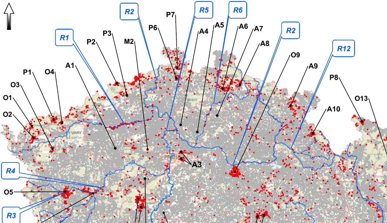
Construction of geochemical maps of risk element concentrations in soils and finding places, where soils were contaminated by anthropogenic activities, can seem like routine tasks. However, the routine lies in only almost automated production of a colour picture and resignation on identification, what in the picture can indeed be attributed to humans. It is definitely possible to evaluate in the map where soils do not meet concentration limits according to the corresponding legislation issued by the Ministry of Agriculture. This (also automated) approach shows two drawbacks. It cannot reveal a weak, but statistically significant increases in risk elements content below those legislative limits, which is typical for diffuse contamination of vast areas affected by persistent sources. On the other hand, automated maps cannot distinguish, where the legislative limits are exceeded because soils had been formed from rocks with naturally elevated risk elements content. Diffuse contamination is, however, relevant for longer time scales, if its sources are persistent, because it can unnoticedly act until the limits are indeed reached and it is too late to prevent this. On the other hand, natural enrichment by risk elements usually does not endanger the food web, because the portion of risk elements is not as bioavailable as anthropogenic contamination. We, however, know, how the map of real anthropogenic impact on soils can be constructed.
Reference: T. M. Grygar, J. Elznicova, S. Tumova, T. Kylich, J. Skala, K. Hron, and M. A. Alvarez-Vazquez, Moving from geochemical to contamination maps using incomplete chemical information from long-term high-density monitoring of Czech agricultural soils. Environ. Earth. Sci. 82 (2023) 6. https://link.springer.com/article/10.1007/s12665-022-10692-3
The archive of other published articles can be found here